


Description
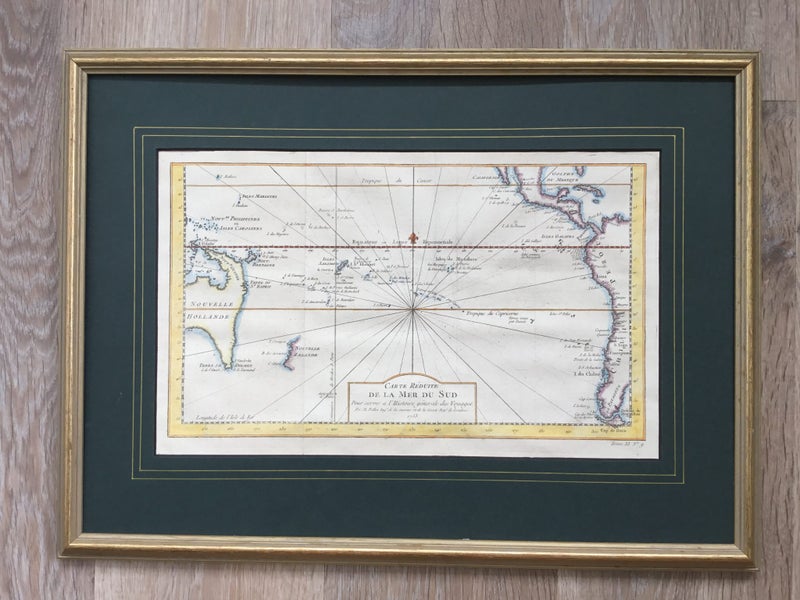
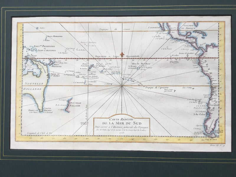
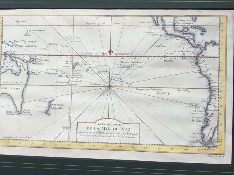
JACQUES BELLIN: "Carte Reduite De la Mer Sud. Pacific., Par le Sr Bellin....", [Paris, 1753], Showing the South Pacific New Zealand and Australia charting by Abel Tasman. The original was produced by Jacques Nicolas Bellin, the inaugural Ingénieur de la Marine of the Depot des cartes et plans de la Marine (the French Hydrographic Office). The present map is augmented with several Dutch translations and a new title at the bottom by the engraver Jakob van der Schley, of Amsterdam. Published nearly 20 years prior to Cook’s "discovery" of the east coast in 1770, Bellin used a dotted line for his theories of the east coast of Australia, joining Van Diemen’s Land to Espiritu Santu (New Hebrides) and Papua New Guinea and New Britain. In French and Flemish, along this imagined coast Bellin wrote "I suppose that the land of Diemen could join with the land of the Holy Ghost but (this is) without proof". In very fine condition hand coloured An exceptionally important and rare piece showing Tasman's charting of the Islands of New Zealand. Plate 380 x 240 mm Frame 530 x 390 mm
Details
Shipping & pick-up options
| Destination & description | Price | |
|---|---|---|
| Track & Trace NZ Post sign for | $20.00 | |
Seller does not allow pick-ups
Payment Options
Pay instantly by card, Ping balance or saved bank account.
Four fortnightly interest-free payments.
Cash, NZ Bank Deposit, PayPal