


Description
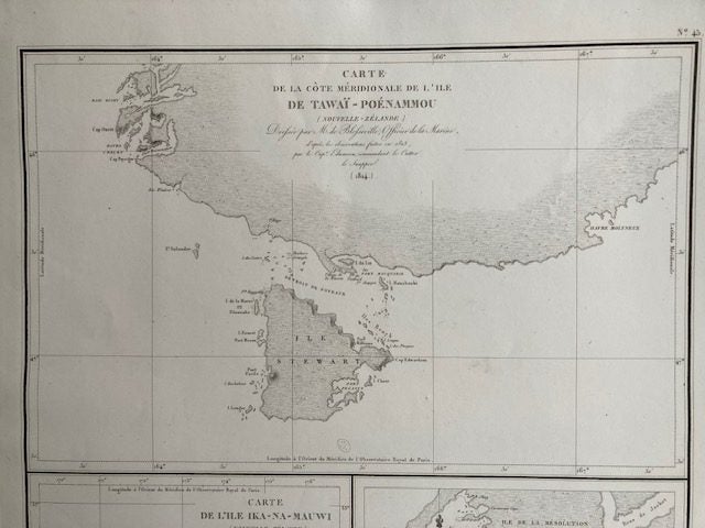
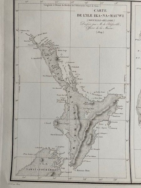
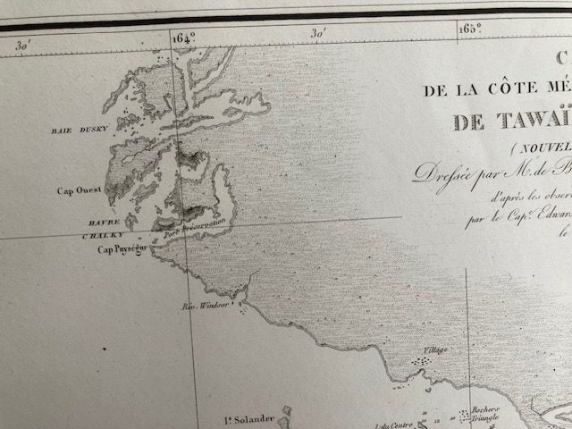
Striking and highly decorative original lithographic set of three nautical maps or sea charts of the coast of New Zealand, on one sheet. The top map shows the southern coast of New Zealand's South Island, along with Rakiura / Stewart Island in its entirety. This is one of the rarest early charting of the Southern Districts of the South Island and in particular Rakiura, Stewart Island. The lower left chart depicts the North Island ( Te Ika-a-Maui), and the lower right chart depicts the Fiordland region, southwest of the South Island, with the Chalky, Anchor, Indian, Long Island and Resolution Islands. Engraved by Ambroise Tardieu, they were surveyed in 1824 by de Blosseville, a naval officer during the expedition of the corvette La Coquille commanded by Duperrey. Paper size 418 x559 mm Exceptionally rare New Zealand map.
Details
Shipping & pick-up options
| Destination & description | Price | |
|---|---|---|
| Track & Trace NZ Post sign for | $15.00 | |
Seller does not allow pick-ups
Payment Options
Pay instantly by card, Ping balance or saved bank account.
Four fortnightly interest-free payments.
Cash, NZ Bank Deposit, PayPal