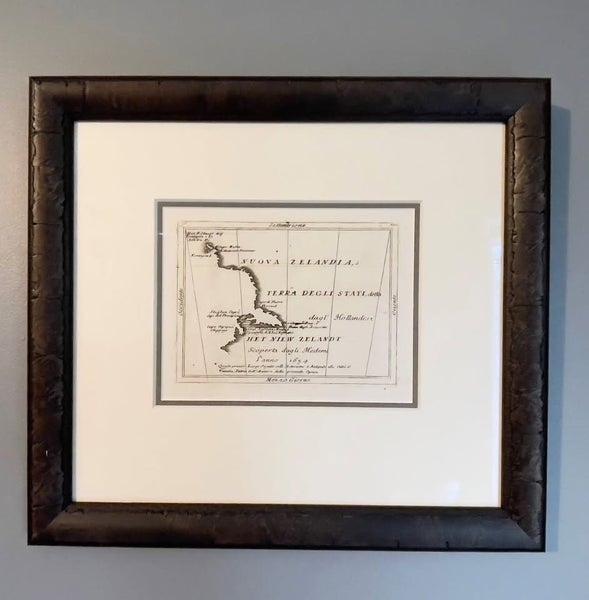


Very Early Map of New Zealand, Abel Tasman 1706 edition (over 315 years old)
Buy now
$3,800
Details
Description
Tasman's Map of New Zealand. A beautiful example of this rare map, presented exceptionally well. Archivally mounted and under museum glass.
Published c.1700-1710,
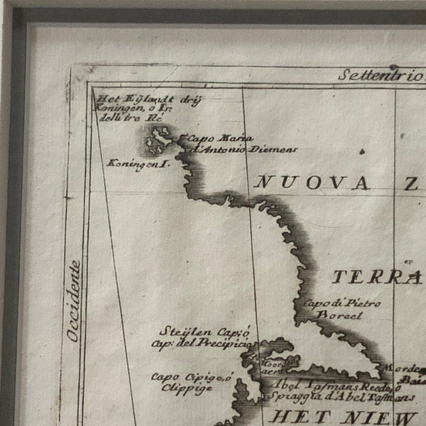
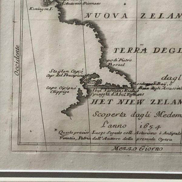
Rare antique map titled 'Nouva Zelanda, ò Terra Degli Stati, detta dagl'Hollandesi Het Niew Zelandt. scoperta dagli medemi l'anno 1654'. Earliest printed copper engraving of New Zealand, after its discovery by Abel Tasman during his travels in 1642 - 1644. With indications on the map by Abel Tasman, Antonie van Diemen, Three Kings Islands and the Murderers Bay. Artists and Engravers: Published by V.M. Coronelli in Venice,1706 Frame size: 370 x 337 Image size:16 x 12 cm.. The map is archivally mounted and under museum glass The Australian national Library's example can be seen at https://nla.gov.au/nla.obj-232672651/view
Shipping & pick-up options
| Destination & description | Price | |
|---|---|---|
| Pick up (Nelson, Nelson Bays) | Free | |
| North Island > Urban / Aramex | $50.80 | |
| North Island > Rural / Aramex | $58.30 | |
| South Island > Urban / Aramex | $33.74 | |
| South Island > Rural / Aramex | $41.24 | |
| Nelson / Tasman > Urban / Aramex | $6.64 | |
| Nelson / Tasman > Rural / NZ Post | $13.55 | |