This listing closed and did not sell. The item has been relisted.
- Browse for similar listings in Maps
- View the relisted item
Other listings you might like


Description
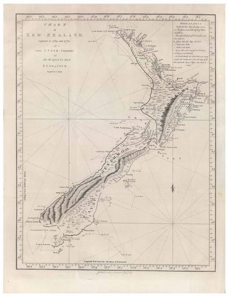
Reproduction Vintage Map of New Zealand 1772
A2 size - (42cm x 59.4cm) will fit perfectly in a A2 photo frame from The Warehouse or Kmart
Nautical chart / map of New Zealand shows the coastline as Cook charted it during his first visit in 1769–70. The track of the Endeavour around New Zealand is also shown. and anchorages & soundings in fathoms. There are some quirky errors such as calling Banks Peninsula an island, and Stewart Island was a peninsula of the South Island.
- Printed size 42cm x 59.4 cm
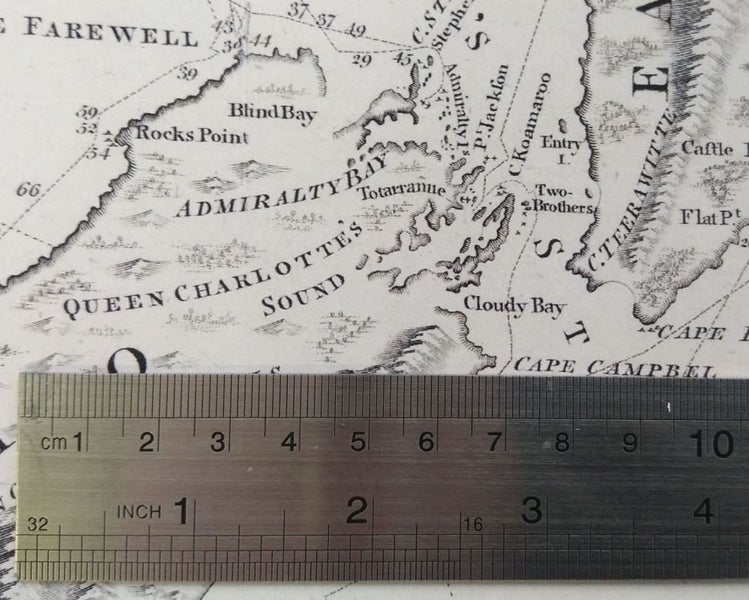
- See 10cm square of map for fine detail
- Professionally printed on 210gsm Matt paper, suitable for framing
- print will be delivered wrapped in acid free tissue paper rolled up in a sturdy tube
Please see my other listings for other sizes & prints and combine to save on shipping
Pick-up is available in Blockhouse Bay
Details
Condition:
Shipping & pick-up options
| Destination & description | Price | |
|---|---|---|
| Auckland 3-4 days, Economy | $6.00 | |
| North Island 3-4 days, Economy | $10.00 | |
| South Island 3-4 days, Economy | $12.00 | |
| Combine with another item you've paid shipping on | $0.00 | |
| Shipping more than one item | No extra charge | |
| Pick-up available from New Lynn, Auckland | Free | |
Estimated delivery times in business days
Payment Options
Pay instantly by card, Ping balance or saved bank account.
NZ Bank Deposit
Questions & Answers
No questions have been asked!
A2 Reproduction Captain Cook map print of New Zealand 1772
Closed: Mon 11th Aug, 5:19pm
C
captivationz ( 205
About the seller
captivationz
100% positive feedback( 205 address verified
Location
Member since
View seller's other listings