


Description
nanoCAD 3DScan is specialized software designed for processing 3D scanning data and tackling engineering and informational challenges across fields such as geodesy, mechanical engineering, construction, infrastructure, and metrological monitoring. It operates as a downloadable vertical application on the nanoCAD platform.
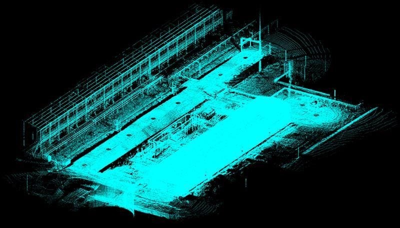
Professional Tool for Laser Scanning Processing 3D scanning is in demand in areas where analysis of the shape and placement of real-world objects is required. It's used in design, modernization of industrial facilities, topographic mapping, and assessment of parameters for existing, planned, or under-construction objects, among other applications.
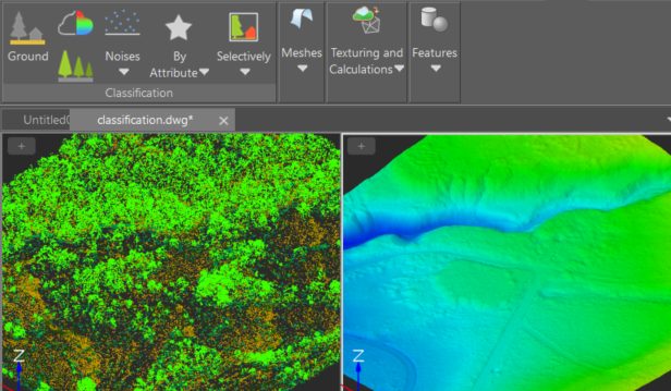
nanoCAD 3DScan features a comprehensive suite of data processing tools, expanding the possibilities when working with point clouds and enabling the resolution of nearly any challenge: Preliminary analysis and processing of 3D scanning results Classification and segmentation of point clouds Creation of Digital Surface Models (DSM) and Digital Elevation Models (DEM) Layer-by-layer vectorization and floor plan construction Detection of basic geometric shapes and complex technological systems Area and volume calculations
3DScan_Flyer_Eng rtnz.pdf >>https://acrobat.adobe.com/id/urn:aaid:sc:AP:58655773-a61f-491d-9723-9f8dc5eb3d46
Details
Shipping & pick-up options
| Destination & description | Price per item | |
|---|---|---|
| To be arranged | N/A | |
Seller does not allow pick-ups
Payment Options
NZ Bank Deposit