

Details
Condition:
Description
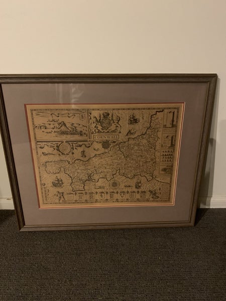
The image shows a framed, circa 17th-century engraved map of Cornwall by Robert Morden. Key details include: It is a hand-colored copper engraving. The map shows villages, boroughs, the city of London, and the Thames River. Features include locations of towns, buildings, forests, rivers, bridges, and parks. It includes a decorative cartouche and distance scales. Published in Camden's "Britannia" between 1695 and 1722. This is a nice print in very good condition
Shipping & pick-up options
| Destination & description | Price | |
|---|---|---|
| Pick up (Christchurch City, Canterbury) | Free | |
| Shipping to be arranged with seller | N/A | |
Questions & Answers
About the seller
brentharper
96% positive feedback( 23 Location
Member since
View seller's other listings