
Description
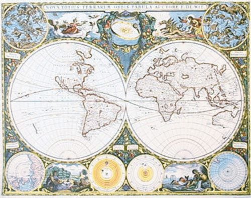
Highly decorative top quality limited edition print of this famous early map that was published approx 50 years ago by a very well known NZ publisher Avon Fine Prints.
This very elegant and interesting early world map as created by famous Dutch atlas-maker Fredrerik de Wit. We understand that it was the first published map to show New Zealand (lower left of map, showing coastline charted by Tasman).
The image size is 17 x 22 inches. It is surrounded by a framing margin and is printed on a beautiful paper.
This map will be delivered to you carefully rolled in a large and very sturdy cardboard roll in perfect condition.
We are happy to combine shipping so please check out our other listings of clearance sale prints from NZ's specialist art print retailer.
Details
Shipping & pick-up options
| Destination & description | Price | |
|---|---|---|
| Christchurch 3-4 days, Economy | $6.95 | |
| Nationwide 3-4 days, Economy | $9.95 | |
| Combine with another item you've paid shipping on | $0.00 | |
| Nationwide 3-6 days, Rural Standard | $14.95 | |
| Shipping more than one item | No extra charge | |
| Pick-up available from Christchurch City, Canterbury | Free | |
Estimated delivery times in business days
Payment Options
Pay instantly by card and Ping balance.
Questions & Answers
Circa 1660! - First Published Map showing NZ Coastline - Distributor Sale
Am I covered by Buyer Protection?
When you make a purchase using any Ping payments like Card or Balance, or Afterpay we are able to protect your trade under our Buyer Protection policy, up to $5,000.
Learn more about Trade Me's Buyer Protection.