
Description
Standard size 61 x 91 cm (or 24 x 36 inch) poster printed in the UK. Shipped from Tauranga so next day delivery is possible to most North Island urban addresses, and 2-3 days to South Island.
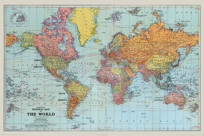
This is a really cool old map from 1920 which includes all the shipping lanes between the world's various ports and also the distances in miles for all those journeys.They are the red lines you can see traced across the oceans!
All posters are shipped to you in a very solid tube by courier.
You only pay freight for the first poster purchased, if buying more than one. Check out my other listings to save on postage.
Cheers
Details
Shipping & pick-up options
| Destination & description | Price | |
|---|---|---|
| Nationwide 3-4 days, Economy | $14.00 | |
| Waiheke Is. 3-4 days, Economy | $15.00 | |
| Nationwide 4-7 days, Rural Economy | $22.00 | |
| Combine with another item you've paid shipping on | $0.00 | |
Estimated delivery times in business days
Seller does not allow pick-ups
Payment Options
Pay instantly by card, Ping balance or saved bank account.
Cash
Questions & Answers
World Map ~ Stanfords General from 1920 ~ Large Historical Maxi Poster
Am I covered by Buyer Protection?
When you make a purchase using Card, Direct Debit, Ping balance or Afterpay we are able to protect your trade under our Buyer Protection policy, up to $2,500.
Learn more about Trade Me's Buyer Protection.