
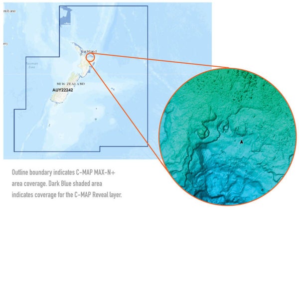


C-MAP REVEAL CHART ELECTRONIC NZ/CHATHAM/KERMADEC
Description
C-MAP® Reveal charts help anglers and divers save time on the water, finding key areas faster with the high-definition views of structure, wrecks and contour changes on the sea floor.
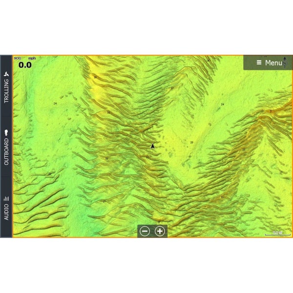
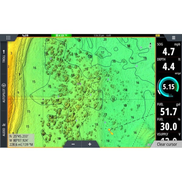
The high-detail C-MAP® Reveal imagery replaces shaded relief data in selected areas with more accurate depth variations, revealing the best fishing and diving spots. C-MAP Reveal charts include C-MAP HRB Coastal Data, Genesis social map data and satellite imagery that can be overlaid on top of the standard vector charts used for navigation. The C-MAP Reveal layer is activated by turning on the Shaded Relief setting and is available for use on these compatible chartplotters:
Simrad:
* Simrad GO * Simrad NSS EVO2 * Simrad NSS EVO3 * Simrad NSS EVO3SLowrance:
* Lowrance Elite Ti * Lowrance Elite Ti2 * Lowrance Gen2 * Lowrance Gen3 * Lowrance Carbon * Lowrance LiveFeatures
* High-definition C-MAP Reveal layer of the sea bottom on selected areas * Reduces search time with immediate display of bottom structure, wrecks, isolated reefs and ledges * Easy to use - just turn on Shaded Relief setting in chartplotter * C-MAP Reveal charts contain full C-MAP MAX-N+ vector navigation data, including new features like High Resolution Bathy * Custom Depth Shading, Genesis layer and satellite imagery * Includes detailed marina and port plans * Most affordable sea bottom charts available * Loaded on Micro SD CardSmart VIP Card prices: Some of these deals may be member deals but don't worry, if you don't have yours yet, we will start you up with one for free.
Auction integration powered by n2 ERP